
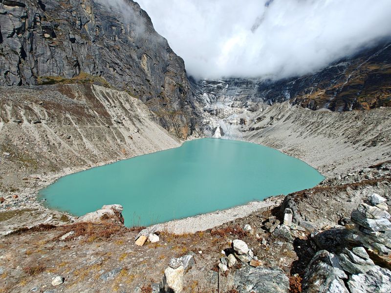
After conducting high-resolution underwater surveys of three major glacial lakes in the Himalayas, Indian and European researchers have found the existing geographical and hydrological data pertaining to thousands of such lakes, which pose a high risk of glacial lake outburst floods (GLOF), to be grossly inadequate.
The lack of data limits the ability of planners and decision-makers to effectively model glacial lake outburst flood hazards, assess risks to downstream populations and evaluate ecosystem vulnerability in the semi-arid, high-elevation landscape.
Across the Himalayan, Karakoram, and Hindu Kush (HKH) mountains, GLOFs constitute a systemic, trans-boundary hazard affecting multiple river basins, infrastructure corridors and vulnerable mountain communities. Their impacts extend beyond immediate flood zones, disrupting hydropower generation, transportation networks, agricultural systems and long-term socio-economic stability. The increasing frequency and magnitude of such events underscore the need to assess GLOF hazards at a regional scale rather than through isolated case studies, the study observed.
“Due to the scarcity of in-situ measurements, most Himalayan studies continue to rely on area–volume scaling. While remote sensing provides valuable information on lake extent and surface characteristics, acquiring bathymetric data in high-mountain environments remains logistically challenging, costly and hazardous, the study observed. Consequently, in-situ bathymetry is extremely limited across the Indian Himalaya, constraining the accurate reconstruction of GLOF hydrographs, peak discharge estimation and forward modelling.
“This highlights a clear research gap in systematic, field-based data acquisition for glacial lakes, particularly in data-deficient regions of the western Indian Himalaya, where direct measurements remain sparse despite the presence of potentially hazardous lakes,” the researchers said.
To address this gap, the National Disaster Management Authority (NDMA) of India has identified 189 high-risk glacial lakes requiring urgent assessment. However, only a small fraction of these lakes has been investigated using direct, field-based bathymetric surveys, underscoring the need for targeted in-situ measurements to complement remote sensing approaches.
In this context, the researchers used an unmanned surface vehicle (USV) to acquire high-resolution bathymetry for three priority lakes — two very high-risk pro-glacial lakes, Gepang Gath and Kadu Nala, and Chandra Tal, the high-altitude Ramsar wetland. “Our findings show that commonly used empirical formulas for estimating glacial lake volume are substantially biased in this region,” said a researcher.
Bathymetry is the underwater equivalent of a topographic survey on land. It measures the depth of the water body and creates a three-dimensional map of its bed using echo sounders, sonar and light detection and ranging (LiDAR) systems. Such mapping is vital for marking navigation channels, environmental monitoring, dredging volume calculations and underwater construction.
The study, conducted by eight researchers from the Birbal Sahni Institute of Palaeosciences, Lucknow, Academy of Scientific and Innovative Research, Ghaziabad, University of Aberdeen, Scotland, Indian Institute of Remote Sensing, Dehradun, and University of Bologna, Italy, was published by Nature’s Scientific Data, a peer reviewed international journal, on July 6.
The HKH mountains form the core of High Mountain Asia and are widely known as the “water tower of Asia,” containing thousands of glaciers and glacial lakes that feed ten major river systems supporting nearly two billion people.
These glaciers are highly sensitive to climate change and are undergoing accelerated melting due to rising temperatures and altered precipitation patterns, which affect snow accumulation, melt rates and hydrological cycles.
This sensitivity is amplified by elevation-dependent warming, in which higher altitudes experience disproportionately greater temperature increases. Consequently, the HKH region has experienced a rapid increase in the number, area, and volume of glacial lakes, the study observed.
“Glacier retreat and lake expansion reinforce each other through a positive feedback mechanism, in which increased melt-water enlarges lakes and expanding lakes enhance glacier calving and retreat. These processes have intensified glacier shrinkage, promoted the formation of new lakes, and increased the likelihood of Glacial Lake Outburst Floods (GLOFs), posing growing risks to downstream communities and infrastructure,” the researchers said.
